Space Research Fund Calls
The Malta Council for Science and Technology would like to announce that it is now receiving applications for the Space Research Fund 2023. Application deadline is 29th of May 11.59pm The Space Research Fund continues to provide financial support for research, development and innovation in the downstream Satellite Earth Observation (EO) sector, specifically projects that deal with the processing and exploitation of data collected through EO satellites. The call is open to all Maltese legal entities under three funding modalities (De Minmis ; GBER ; State Aid n/a). An applicant or each partner within a consortium is to opt for one funding modality, making use of the respective rules and application template accessed below. A proposal can apply for a grant of up to €150,000 in order to carry out their research projects during a period of 20 months across two stages. Funded projects under this Call must start between August and September of 2023. Information Sessions about the Call: MCST together with ESA will deliver an information session about the Call. The session will be held at MCST: 26th April, between 9:00 and 11:00Hrs The information session materials can be found in the tabs below. You may request a copy of the recording by sending an email to space.mcst@gov.mt. You may also book a one-to-one session with an ESA representative to discuss your proposal. You will be able to meet them in person on the 26th April after the info session from 1.30pm onwards, and on the 27th of April. Please book an appointment in advance by sending an email to space.mcst@gov.mt
Applicants with proposals that do not fall under State Aid:
Applicants applying under the De Minimis/GBER funding modality:
Space Research Fund 2022 Call is Closed!
The Malta Council for Science and Technology would like to announce that it is now receiving applications for the Space Research Fund 2022. Application deadline is 11th July 11.59pm. The Space Research Fund continues to provide financial support for research, development and innovation in the downstream Satellite Earth Observation (EO) sector, specifically projects that deal with the processing and exploitation of data collected through EO satellites. The call is open to all Maltese legal entities under three funding modalities (De Minmis ; GBER ; State Aid n/a). An applicant or each partner within a consortium is to opt for one funding modality, making use of the respective rules and application template accessed below. A proposal can apply for a grant of up to €150,000 in order to carry out their research projects during a period of 20 months across two stages. Funded projects under this Call must start between October and November of 2022.
Information Session about the Call:
MCST together with ESA will deliver an information session about the Call. The session will be held online, and recorded on 31st May, between 14:30 and 16:30 hrs. You can register for the session on the following link: https://forms.gle/CQ6hp3KKhBTpdmZo6 The information session materials can be found in the tabs below. You may request a copy of the recording by sending an email to space.mcst@gov.mt.
Call Documents:
Note: for queries, please reach out to space.mcst@gov.mt
Applicants with proposals that do not fall under State Aid:
Applicants applying under the de minimis funding modality:
Applicants applying under the GBER funding modality:
Regulations:
Space Research Fund 2021 Call is CLOSED!
The Malta Council for Science and Technology would like to announce that it is now receiving applications for the Space Research Fund 2021. Application deadline is 18th June c.o.b.
The Space Research Fund continues to provide financial support for research, development and innovation in the downstream Satellite Earth Observation (EO) sector, specifically projects that deal with the processing and exploitation of data collected through EO satellites. The call is open to all Maltese legal entities under three funding modalities (De Minmis ; GBER ; State Aid n/a).
An applicant or each partner within a consortium is to opt for one funding modality, making use of the respective rules and application template accessed below. A proposal can apply for a grant of up to €150,000 in order to carry out their research projects during a period of 20 months across two stages.
Funded projects under this Call must start between September and October of 2021.
Information Sessions about the Call:
MCST together with ESA delivered two information sessions about the Call. Both sessions were identical, held online, and recorded:
- 30th April, between 12:00 and 14:00
- 7th May, between 12:00 and 14:00
The information session materials can be found in the tabs below. You may request a copy of the recording by sending an email to space.mcst[at]gov.mt.
Call Documents:
Note: for queries, please reach out to space.mcst@gov.mt
Applicants with proposals that do not fall under State Aid:
Applicants applying under the de minimis funding modality:
Applicants applying under the GBER funding modality:
Regulations:
Space Research Fund 2020 call is now closed
The Malta Council for Science and Technology would like to announce that it is now receiving applications for the Space Research Fund 2019. Application deadline is 22nd May 2020 c.o.b.
Due to the current restrictions related to the ongoing COVID-19 pandemic, applicants are not required to stamp or sign a hard copy of the application form at this stage. Each submission must however include a completed one page Letter of Intent (use template provided below), physically signed by the respective legal representatives. All submissions are to be sent to the council in electronic format.
The Space Research Fund continues to provide financial support for research, development and innovation in the downstream Satellite Earth Observation (EO) sector, specifically projects that deal with the processing and exploitation of data collected through EO satellites. The call is open to all Maltese legal entities under three funding modalities (De Minmis ; GBER ; State Aid n/a). Applicants are to apply under only one funding modality, making use of the respective rules and application template.
Applicants applying under the De Minimis Funding modality:
Applicants applying under the GBER funding modality:
Applicants with proposals that do not fall under State Aid (SA):
ESA resources available to all applicants:
Regulations:


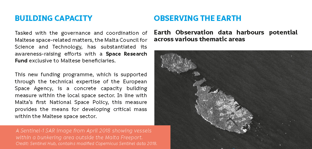
In substantiating space-related awareness raising, the Malta Council for Science and Technology has sought to establish a Space Research Fund that provides financial support for research, development and innovation within the area of Satellite Earth Observation. This new funding programme, which is supported through the technical expertise of the European Space Agency through a formalised Implementation Arrangement, is indeed a modest start to capacity building within the sector.
The potential of Earth Observation (EO) data, including free and open datasets made available through Copernicus, the EU Earth Observation programme, can only be fully exploited by value-adding downstream services, which are tailor made to specific public and commercial needs. Such solutions, often encompassing research and development at the intersection of science and ICT, translate the unprocessed and raw data delivered from EO satellites and other in-situ sensors into information that is usable by the end user.
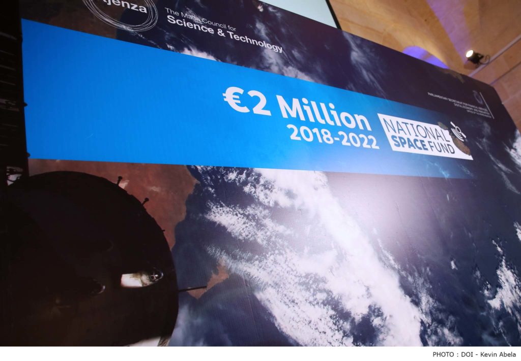
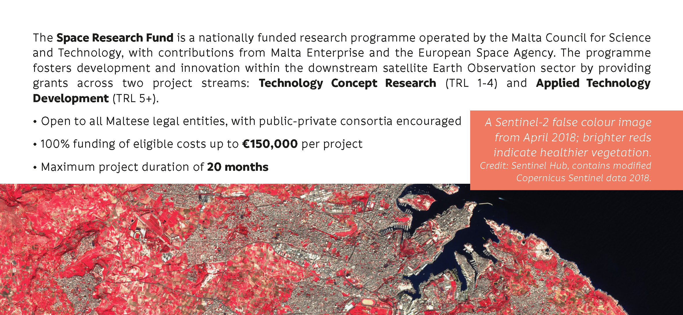
The Space Research Fund provides financial support for research, development and innovation in the downstream satellite EO sector, specifically projects that deal with the processing and exploitation of data collected through EO satellites. This is a concrete capacity building measure within the Maltese downstream Satellite EO sector within the prime objective of achieving a critical mass of knowledge within the sector. Grants are awarded on the basis of yearly competitive calls for 20-month projects.
Presentations associated with the previous call
Documents associated with the previous call
Space Research Fund Brochure


Previously Funded Projects
BATHMALTA
Benficiary: University of Malta Coordinator: Prof Aaron Micallef The proposed research addresses two specific needs that characterise the Maltese Islands: an extensive survey of shallow seabed information, and a time series on the submarine groundwater discharge within the coastal and nearshore setting. The Maltese Islands represent an ideal location to test out the viability of a workflow for obtaining a new b  athymetric layer from satellite derived information (Satellite Derived Bathymetry, SDB). This new set of information will be acquired through the use of Sentinel-2 and Sentinel-3, two missions specifically launched for the surveys of sea topography and sea-related properties. During the first stage of this proposed project the team will select three study areas around the Maltese Islands where there are better chances for the satellite to acqu ire reliable images. Machine Learning techniques will be critical within this phase (Stage 1) for improving the classification of the depth to the seafloor. A validation of the technique tested formerly on three areas will then be extended across the whole Maltese Archipelago. Within the area delimited by the new bathymetric fringe produced from satellite data, data acquired from the infrared sensors of Sentinel-3 will be used for ident ifying submarine groundwater discharges. This research objective will be attained during Stage 2 of this project and will contribute in better understanding the migration of groundwater system from onshore through coastal systems in the nearshore or in the offshore setting. This research will allow Malta to be the first European country with the entire coastal and nearshore setting updated with Satellite Derived Bathymetry, and to have shallow areas, which usually are poorly surveyed because of navigation issues, to be equipped with a novel workflow and data output. The capacity built with this research pro ject enables the marine geology community of the University of Malta to learn to use and exploit satellite data. These skills have the great potential to be transferred to other multidisciplinary and interdisciplinary research projects that will entail handling and interpretation of satellite data for bathymetric or topographic purposes, as well as groundwater discharge monitoring.
DEMUWA
Beneficiary: University of Malta Coordinator: Prof Sebastiano D`Amico The management of groundwater resources, especially in arid and semi-arid regions, forms a crucial component of 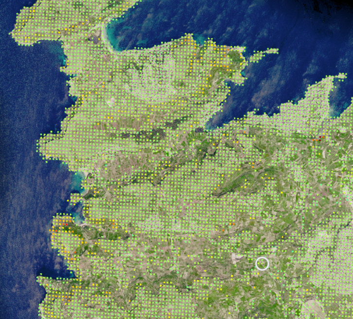 national policy. Mediterranean countries are experiencing crises in groundwater availability as a result of a number of economic, social, and environmental conditions. Therefore, efficient management of groundwater resources is dependent on accurate knowledge and understanding of the behavior and variability of the aquifers. Such knowledge is often lacking or limite d to sparse and highly localized information. DEMUWA, a multi-scale, multi-disciplinary, geophy sical, and hydrological investigation on groundwater proposes to use satellite data with additional physical constraints, to improve continuous monitoring of underground water reservoirs. In particular, the project aims at monitoring the upper water table within the Maltese islands. One of the key benefits of the project is to the ag ricultural sector by ensuring the establishment of a low-cost and effective monitoring system to monitor the quantitative status of groundwater bodies used for irrigation (especially in the northern part of the Maltese archipelago), thus ensuring that problems are identified as early as possible to enable policymakers to address them on time.
BEEPOLL
Beneficiary: Pixam Ltd. Coordinator: Mr Steve Zerafa Bees are more than just cute insects – it’s an economic powerhouse that plays a crucial role in our food supply. In fact, the economic value of pollination worldwide is estimated to be at least €153 billion, and that’s just the tip of the iceberg. In Malta alone, the value of pollination is estimated to be €8 million yearly, highlighting the significant impact that bees have on our economy. ![]() Despite their vital role, bees are facing a range of thr eats, from climate change and habitat destruction to pesticide use. These pressures are taking a toll on bee populations, and this could have devastating consequences for o ur food security. To study these trends and find solutions, the team behind the Beepoll project is using cutting-edge technology like remote sensing techniques on medium to high-resolution satellite images, coupled with 2D neural networks. The ultimate goal of the project is to provide tools that can help identify the best locations for translocating honeybees for crop pollination in Malta. This innovative approach has the potential to make a real difference in bee conservation and food security.
Despite their vital role, bees are facing a range of thr eats, from climate change and habitat destruction to pesticide use. These pressures are taking a toll on bee populations, and this could have devastating consequences for o ur food security. To study these trends and find solutions, the team behind the Beepoll project is using cutting-edge technology like remote sensing techniques on medium to high-resolution satellite images, coupled with 2D neural networks. The ultimate goal of the project is to provide tools that can help identify the best locations for translocating honeybees for crop pollination in Malta. This innovative approach has the potential to make a real difference in bee conservation and food security.
STREAM
Beneficiary: Malta College of Arts, Science and Technology (MCAST) Coordinator: Prof Aldo Drago Scientific endeavours and timely technological solutions are gaining unprecedented momentum to address growing challenges for sustainable development, climate-related targets, and higher performance in applied research, innovation, and economic excellence. Quality data is the common ingredient, delivered where and when it is needed, operationally in real-time or in delayed mode, to generate information, knowledge and added value for multiple applications. As more users rely on information deriving from multiple data sources including satellites, the non-professional users are also increasing in numbers with their pertinent demands. The STREAM project takes advantage of the technology step shift in the value addition chain of data, transforming data into information, knowledge, and intelligence, providing sophisticated user experiences online, with faster delivery and service elaborations on a wider range of more affordable smart mass media like smartphones, tablets, and other wireless devices. In particular, remote-sensing data are increasingly becoming an essential resource in applications to improve the quality of life and safety of citizens, for risk assessment, environmental monitoring, surveillance, scientific discovery as well as economic STREAM is mainly intended to enhance the level of access and application of space data with local users, including the citizen level, to facilitate the integration of such data into daily endeavours by operators and responsible entities, for decision-making, higher efficiency, and performance at reduced risks, delivering tailor-made and added value services needed at different scales, disciplines, and levels of society. The project provides an intermediate platform dedicated to data fields c 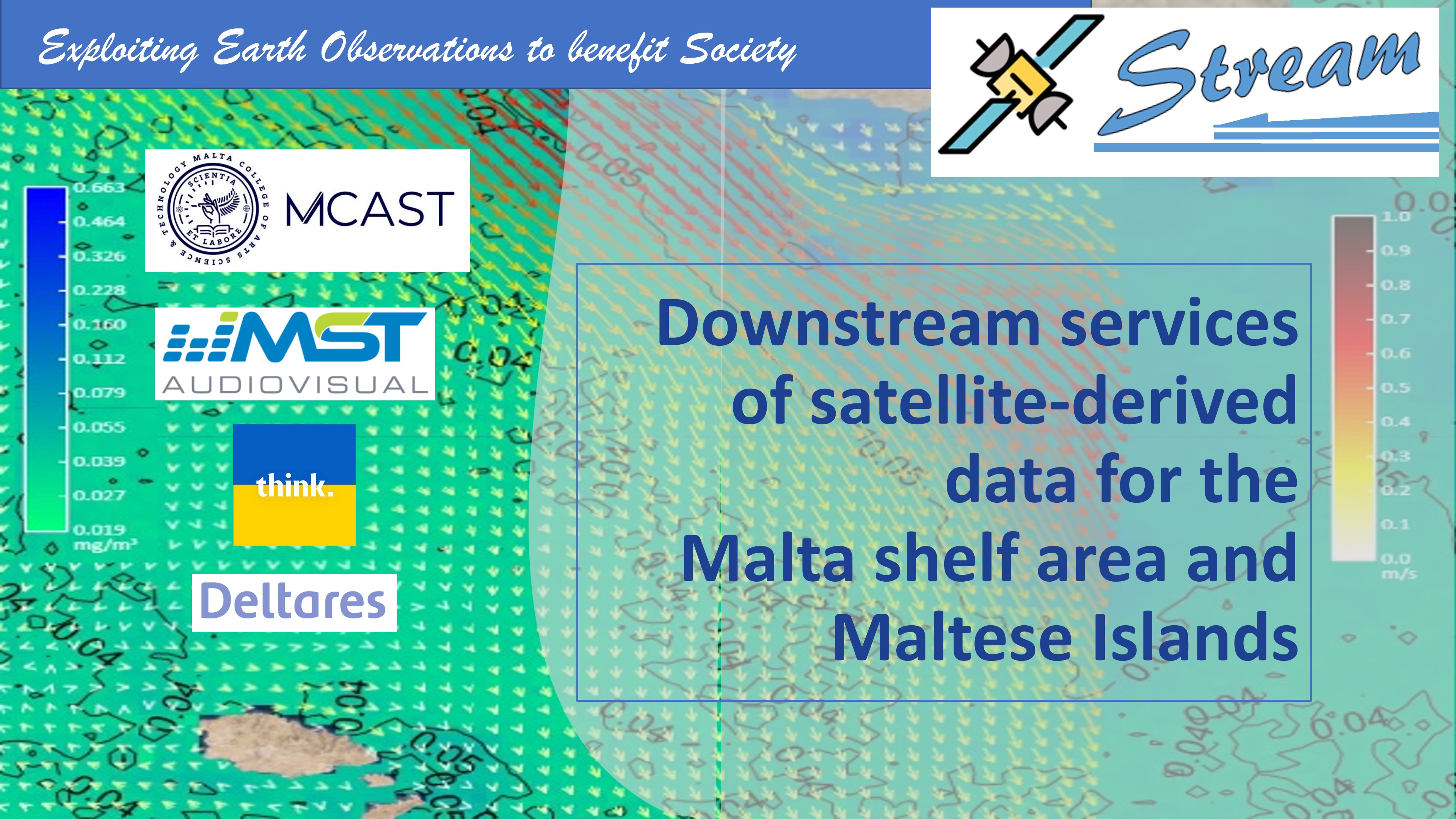 overing the Maltese Islands and its vicinity, channelling data easily and customised to user needs from satellite data sources such as the COPERNICUS Marine Environment Monitoring Service (CMEMS). Using state-of-the-art technology in API and UI development, the project delivers a specialised service seamlessly linked to CMEMS, providing data to local u sers, and with the potential to replicate in other countries and regions. The project serves as a prototype leading to further exploitation for next generation services, strengthening links between European data platforms and the national scale systems. The project execution led by the scientific and technical inputs from the newly established oceanography section at the Institute of Engineering and Tr ansport of the Malta College of Arts, Science and Technology will be supported by the practical implementing skills of two Maltese SMEs (MST Audiovisual Ltd and THINK Design Ltd), and the scientific excellence of DELTARES engaged on subc ontracting basis, bringing together into the project the expertise for system design, setup, and operation, as well as for the user interfaces and a branded service delivery on electronic hand-held devices.
SATELLITE4HEALTH
Beneficiary: University of Malta Coordinator: Dr Lalit Garg
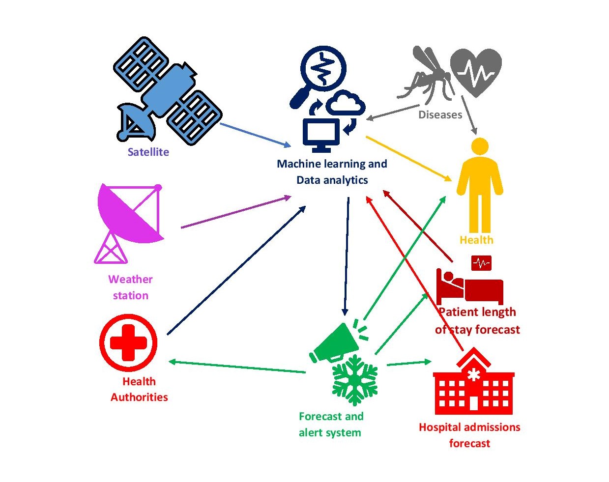
Grant Awarded: €149945 Digital twin, a part of Destination Earth (DestinE), will continuously observe climate and weather to study the earth and human activities. This information can also help in improving public health. Therefore, we propose a tool to analyse spatiotemporal datasets collected and processed from Copernicus (primarily Sentinel-3), MODIS, EUMETSAT, and Maltese weather stations to forecast the hospital admission rate and patient duration of stay. The proposed tool can investigate the unexpected change in the patient admission rate, duration of stay, and responsible factors, including some outbreaks or abnormalities needing urgent attention, such as bioterrorism, the negative impact of some policies or managerial decisions. It will help healthcare managers and policymakers better manage healthcare services. The project will focus on public health in general without targeting any particular disease. It might also include the development of novel data analytics techniques for the fusion of multiple satellite’s datasets.
MAARES
Beneficiary: Ambjent Malta Coordinator: Mr Alexander Borg Galea Grant Awarded: €150000 Posidonia oceanica is a marine vascular plant endemic to the Mediterranean Sea. It is a cardinal part of the Mediterranean sea’s ecosystem by providing oxygen to coastal waters and contributing to benthic habitat complexity. Indeed, P. oceanica plays an important role as a primary producer, as well as providing a habitat and breeding ground for many marine animals including crustaceans, sea urchins, clams and endangered species such as turtles as well as marine mammals. Consequently, Posidonia meadows are listed as a priority habitat at European Union (EU) level (Habitat Directive 92/43/CEE) and are closely monitored as part of the Marine Strategy Framework Directive (2008/56/EC) (MSFD). The data collection process is a key response to policy implementation and habitat conservation measures to safeguard this vital habitat. Past data collection approaches, employing both in-situ and ex-situ surveys, highlighted the need to attain higher resolution data at larger spatial scales and more frequent temporal scales to define with precision the geographical extent and health status of this habitat. This approach will not only inform the development of policy, but will also provide Ambjent Malta and Environment and Resources Authority (ERA) with the necessary knowledge to implement applied habitat conservation initiatives in Marine Protected Areas and Territorial Waters of the Maltese Islands. Taking cue from this necessity, Ambjent Malta, in collaboration with Project partners; ERA, University of Malta (UoM) and PIXAM Ltd., is implementing the MAARES project (Mapping & Monitoring of Posidonia oceanica using Remote and Sentinel Technology) SRF-20211S2 funded by the Malta Council for Science and Technology’s (MCST) Space Research Fund. The ultimate objective of this project is to develop and test a novel methodology to complement the existing data-gathering toolbox for sea grass meadows which ultimately enables more efficient management and conservation of P. oceanica in this epoch threatened by the increasing human-based influences including climate change.
SIPOBED
Beneficiary: University of Malta Coordinator: Dr Sebastiano D`Amico Grant Awarded: €140277 Coastal erosion is a phenomenon of great importance to the Maltese Islands as the coast is one of the most-intensely used and visited areas. Even if the largest extension of Maltese shore is constituted by rocky shoreline (98% of Maltese coastline) the pocket beach and sandy beach systems play a key role both from an environmental and touristic point of view. The SIPOBED project will use remote sensing techniques to detect and monitor movement of sediments within the Maltese pocket beaches. Research and development in the downstream Earth Observation (EO) sector is key to achieving a reliable and cost-effective monitoring of coastal erosion and within this project we aim to provide detailed estimates of sediment variations through time. In this interdisciplinary project, we will use image processing and deep learning techniques and these estimates will be validated through in-situ measurements. Physical models will be used to interpret the deformation according to the local geology and geomorphology. Data will be finally integrated within a GIS system and a tool will be developed and such a tool made freely available to potential stakeholder. The project places strong emphasis on capacity building and dissemination across government and other stakeholders to achieve a critical mass of knowledge within the EO sector.
Coastal-SAGE
University of Malta & MTIP / September 2020 to May 2020
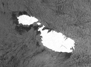
Sentinel-1 SAR Ground Range Detected acquisition of the Maltese Islands on the 2nd June 2020 (VV polarization)
Coastal erosion is an unrelenting phenomenon which is of importance to the Maltese Islands as the coast is one of the most-intensely used and visited areas. Erosion along the rocky shoreline (98% of Maltese coastline) poses hazards to life, infrastructure and cultural heritage. The Coastal SAGE project involves a consortium composed of the University of Malta as lead partner and The Ministry for Transport, Infrastructure and Capital Projects (MTIP) as a partner, and will use remote sensing to detect and monitor rock tilting and motion, which may be precursors to hazardous coastal landslides. The MTIP, responsible for mitigating these risks, faces major challenges when tackling this multifaceted problem impacting diverse environmental and socio-economic interests. Current practice is deemed highly unsatisfactory, being predominantly reactive and driven by visual site inspections of reported danger cases. Research and development in the downstream Earth Observation (EO) sector is key to achieving a reliable and cost-effective monitoring of coastal erosion. Persistent Scatterer Interferometry (PSI) techniques utilize Synthetic Aperture Radar (SAR) onboard satellites (e.g. Sentinel-1) to provide millimetric deformation estimates.
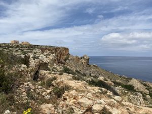
Block sliding phenomena and boulder scree in one of the Study Areas which will be considered by the Coastal SAGE project – Selmun Promontory.
However, SAR suffers from speckle noise, which if uncorrected will affect the PSI processing pipeline and the resulting deformation maps and their interpretation. In this interdisciplinary project, UM will use image processing and deep learning techniques to address two key aspects of the PSI pipeline: denoising of interferometric phase and phase unwrapping. We will integrate our denoising and unwrapping methods within the open-source StaMPS/MTI software, and use a combined Persistent Scatterer and Small Baseline approach in order to estimate deformation and displacement in 6 Study Areas around Malta and Gozo. These estimates will be validated through in-situ sensors. In addition, high-resolution Digital Elevation Models of all Study Areas will be acquired using LIDAR equipped drones, which will be used in the PSI pipeline. Physical models will be used to interpret the deformation according to the local geology and geomorphology. A risk assessment using environmental and socio-economic indicators will be performed, integrating the data derived from this project, with results mapped spatially to support a GIS service. This will allow authorities to monitor the hazards associated with coastal erosion in Malta, whose small size and prevalence of different geomorphological processes for coastal erosion make it an ideal testbed to prototype these applications. The project places strong emphasis on capacity building and dissemination across government and other stakeholders to achieve a critical mass of knowledge within the EO sector. It interacts with key stakeholders throughout, with training needs analysis and courses customised to target governance needs of different entities.
WARM-EO
University of Malta & Energy and Water Agency (EWA) & Silesian University of Technology (Poland)
October 2020 to June 2022
Copernicus: Sentinel 2 Satellite
Malta has a semi-arid Mediterranean climate with high annual variability in the annual rainfall and high evapotranspiration rates leading to a low availability of natural renewable water resources for sustaining the production of drinking water, the water demand of agriculture and economic activities, as well as the needs of the environment. This, coupled to a high population density exerts a significant pressure on natural water resources and associated ecosystems. The Energy & Water Agency participated in the Water Over-abstraction and illegal Water Abstraction Detection and Assessment (WODA) project and concluded that earth observation (EO) imagery can be used for water resources management. However, the majority of agricultural holdings in Malta and Gozo are relatively small, with 75.6% of the agricultural holdings are smaller than 1.0 hectare each. Moreover, preliminary discussions with the Energy & Water Agency and Ministry of Agriculture revealed that dividing parcels (e.g. 10 × 10 m) in different small plots (also referred to as multicropping) is a common practice in Malta. Crop water demand can be estimated using evapotranspiration on a pixel by pixel basis, using the FAO model that uses in-situ measurements of wind speed, temperature, relative humidity and solar radiation. Alternatively, one can use remote sensing to estimate evapotranspiration without the need of installing a meteorological station in every field. Nevertheless, the thermal sensors equipped on existing satellites provide a coarse resolution (~100 m for Landsat-8 or 1 km for Sentinel-3). Moreover, vegetation indexes such as the normalized difference vegetation index (NDVI) suitable to estimate the crop coefficient are measured using information from the visible and near-infrared bands from Sentinel-2, which provide a resolution of 10 m. Both these resolutions are not suitable for small areas with the same crop type which is the case of Malta and other regions in southern Europe such as Cyprus, Greece and islands where land parcels tend to be even smaller than Malta. The sector problem area addressed by this project is that there is a need to increase both optical and thermal resolution to estimate the water volume used for irrigation at parcel level. The main technical objectives of this project are to:
- Develop a crop evapotranspiration estimation model using EO imagery and in-situ data from a sparse set of anchor fields for tomatoes, potatoes and vineyard;
- Increase the spatial resolution of B4 and B8 bands of Sentinel-2 by a factor of three to obtain a resolution of 3 m.;
- Estimate the land surface temperature at parcel level using Sentinel-3, NDVI and in-situ measurements from a sparse set of anchor fields.;
- Develop an open-source Web GIS water resources management platform which can be used to monitor water use at country level.
WaterColours
University of Malta / November 2019 to July 2021
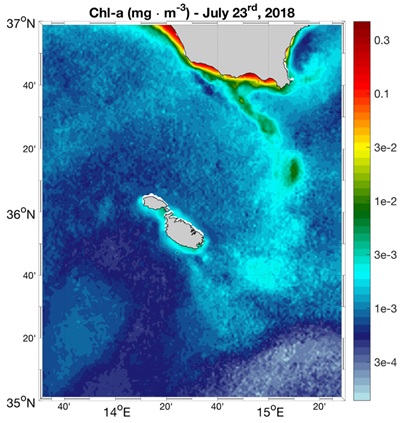
Mediterranean Sea interpolated surface chlorophyll concentration from multi satellite and Sentinel-3 OLCI observations.
Remotely sensed data are increasingly becoming an essential resource in applications to improve the quality of life and safety of citizens, for risk assessment, environmental monitoring, surveillance, scientific discovery as well as economic exploitation. The launch of the Ocean and Land Colour Instrument (OLCI) on board the European Space Agency (ESA) Sentinel-3A and 3B satellite platforms in February 2016 and April 2018 respectively, are opening a new era in coastal water remote sensing. The OLCI is dedicated specifically to oceanography and provides continuous long-term data flows to monitor environmental parameters with high accuracy and resolution, and to understand and mitigate the effects of climate change.
WaterColours is a new project of the Physical Oceanography Research Group (PO-Res.Grp) at the Department of Geosciences of the University of Malta. This was recently approved for funding by the Malta Council for Science & Technology, for and on behalf of the Foundation for Science and Technology, through the Space Research Fund that provides financial support for research, development, and innovation in the downstream Satellite Earth Observation (EO) sector. The project is intended to exploit satellite multispectral imagery for the estimation of ocean colour parameters in the Maltese coastal areas with an unprecedented detail within harbours, embayments and the nearshore open sea areas.
During the first phase of the project, satellite-based climatologies and statistical trends for surface Chlorophyll-a concentrations and Total Suspended Matter (TSM) will be computed at a high resolution. Apart from the baseline variability of the biogeochemical properties, these results will provide very important markers of eutrophication as well as suspended sediment loading or starvation areas. In the second phase, ocean colour products will be operationally computed at a high spatial resolution by taking advantage of data from Sentinel-3. These full-resolution datasets will be integrated to other data layers to add to the already existing services offered by the PO-Res Grp. The generated Chlorophyll-a and TSM concentration maps will be embedded in an interactive downstream service that will relate the sea surface biogeochemical properties to water quality, and provide essential indices for the Water Framework Directive (WFD) and the Marine Strategy Framework Directive (MSFD). In-situ data will be measured for the calibration and validation of results.
All results will be made publicly available through an online portal that will embed Machine Learning and image processing techniques. These will automatically detect and highlight specific phenomenologies such as harmful blooms or areas with a high TSM content, and provide automated alerts of such events to the Environment Resources Authority (ERA).
WaterColours will provide an important opportunity and will help apply the current state-of-the-art methods to the Maltese coastal waters to create unprecedented slow time critical (STC) parameters datasets. Apart from further utilising and exploiting the COPERNICUS marine platform to produce tailor made services at the coastal scale, this initiative will strengthen the local capacity in the exploitation of satellite data, and paves the way for a stronger presence of Malta in the European space sector.
The success of the project will only be possible through collaboration between a core team from the University of Malta and a group of experts from the Italian National Research Council, Institute of Marine Sciences (CNR-ISMAR). The project is led by Dr Adam Gauci together with Prof. Aldo Drago from the PO-Res Grp. Dr Daniele Ciani and Federico Falcini from CNR-ISMAR are also part of this team. WaterColours will permit us to paint satellite derived ocean colour fields around the Maltese Islands with a finer paintbrush!
EO4HBCS
University of Malta / November 2019 to July 2021
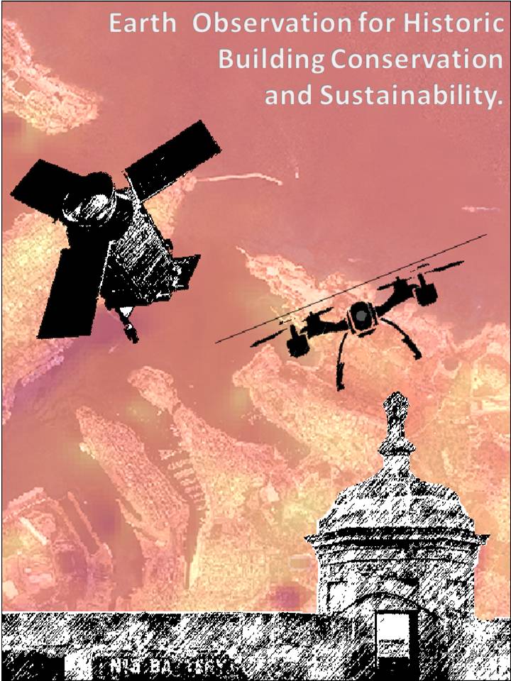
The research project entitled ‘Earth Observation for Historic Building Conservation and Sustainability’ (EO4HBCS) is being coordinated entirely by the University of Malta, specifically by the Department of Conservation and Built Heritage Department of the Faculty for the Built Environment and by the Institute of Earth Systems. It aims at studying the behaviour of traditional unmodified roofs (built of limestone slabs on arches or beams, and with a lime-based “deffun” coating), traditional modified roofs (with insulation, membranes, etc), and modern roofs, as a first in Malta, promoting this as as a possible test-bed for the many types of similar structures elsewhere in the wider Mediterranean Basin.
The research will be using a combination of Earth Observation data with unmanned aerial vehicle (UAV) aerial reconnaissance and in situ measurements of chosen historical buildings which fit the various chosen categories as mentioned above. These will be primarily located in the Valletta and Cottonera areas of Malta. Monitoring the temperature and related (moisture) parameters of these roofs will help understand the effects of modern “adaptations” on general building behaviour, primarily in the upper storey, and occupant well-being. It aims at utilising various remote sensing techniques as an important part of the study. Imagery data obtained from sensors mounted on low-cost UAV platforms will be fused with high resolution multispectral satellite imagery.
The studies will be based, in part, on studies carried out to date on modern “cool roofs” and “green roofs”. It will also include an innovative part in that thermal and other EO data will be used for the first time to quantify an effect which has for centuries been felt and appreciated by the occupants of such buildings, and to be able to present these data to decision-makers, conservation architects and users of such buildings. It is also hoped that lessons learnt from this project will be transmitted to neighbouring Mediterranean countries, where traditional materials, building technology and climate regimes are similar.
AEROTOX
MCAST / January 2020 to August 2022
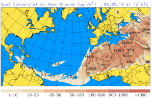
Throughout the whole year, south European countries experience dust-laden winds blowing from the Sahara desert, called ‘Sirocco” which cause “seasonal haze episodes” which sometimes even result in mud rain. There are various words which describe this natural activity, including Harmattan used in West Africa Region for the dust created from November till March or Ghibli as used by North Africans tribes which is normally caused in Summer season. The phenomenon affects society in different ways notably
- Transport and Communications – Affects visibility at airports and shipping lanes and radio communications
- Health – The dust in the air produces dry skin and cracked lips. It also presents more serious problems for asthmatics – and can lead to silicosis, a lung disease caused due to a high content of quartz in the dust.
- Generation of Electricity from PV Panels – The lack of visibility reduces the efficiency of PV panels hence the need for extra generation from the power stations.
The aim of this research project is to use the Satellite Sentinel 5p datasets daily to predict the Saharan desert movement over the south Mediterranean region in advance at a very high resolution of 7x3km as opposed to 10x10km which are available today. The prediction model core algorithms will make use of the UV aerosol Index from sentinel 5p, and the prediction results are to be available for free online at a cloud Grid Geographical Information system, which will be created on purpose for this research study. Having such a system in place would be beneficial for the Malta Health Directorate, and the people at large, as the former would be able to inform the public ahead, who also would be able to check on a daily basis the Sahara Desert aerosols prediction for the days to come, and therefore precautions could be taken if necessary.
PIXAM
MCAST and MESDC / September 2018 to May 2020
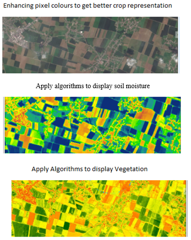
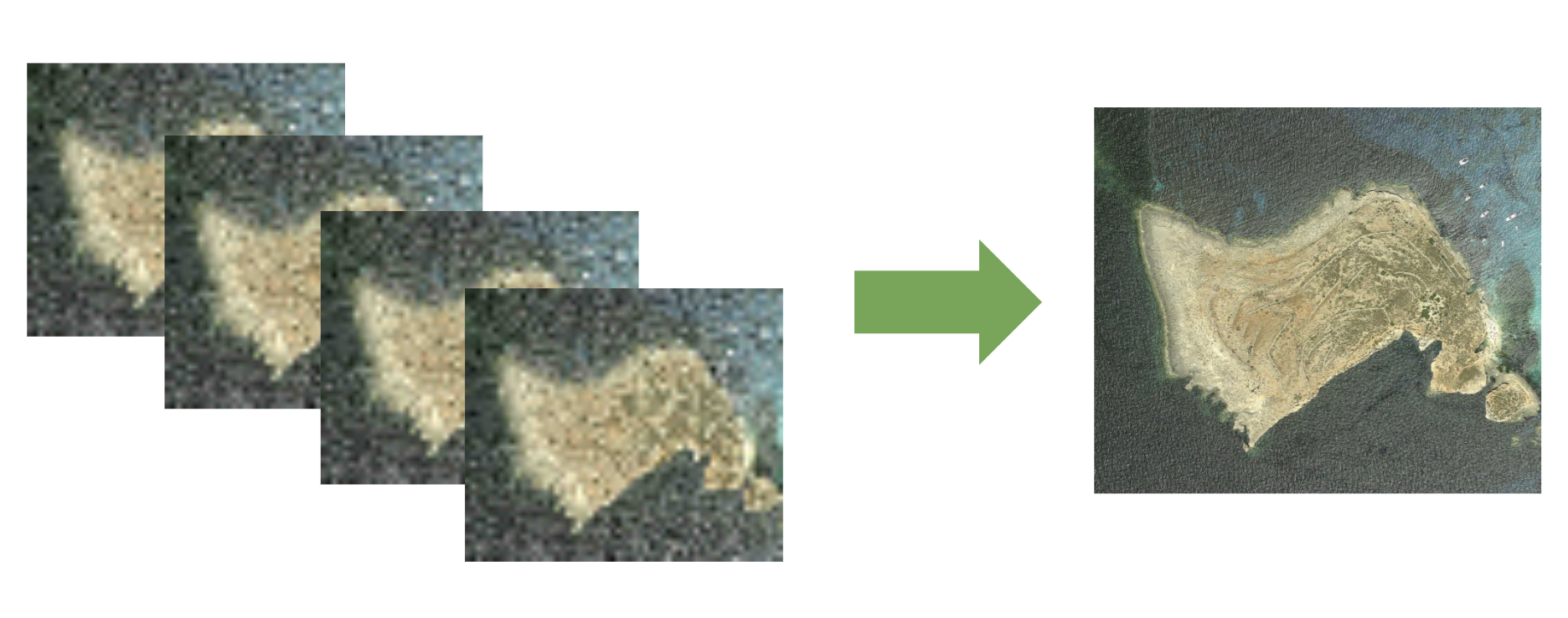
An example illustrating key steps in identifying patterns in satellite imagery (MCAST 2018)
Pixels and More (PIXAM) is a research project coordinated by the Malta College of Arts, Science and Technology (MCAST) in collaboration with the Ministry for the Environment, Sustainable Development and Climate Change (MESDC) which will make use of datasets supplied by Copernicus Sentinel 2 satellites. The project, led by Mr Steve Zerafa (MCAST), exploits the fact that Sentinel satellites provide full coverage of the Maltese islands every few days in 13 multispectral bands. The research seeks to develop deep learning algorithms that enhance the resolution and consistency of the satellite datasets. The algorithms to be developed shall help depict pixels patterns and aid in better understanding the dynamics of the local habitat, including mapping of selected crop patterns and soil moisture across agricultural fields and valleys.
SAT-FIRE
University of Malta / September 2018 to May 2020
Techniques such as data fusion and super resolution can allow oceanographers to improve the accuracy of marine current models in coastal areas. (University of Malta, 2018)
The University of Malta, interfaculty project entitled “SATellite data Fusion and Imaging Resolution Enhancement for coastal areas” (SAT-FIRE) is led by Dr Ing. Gianluca Valentino together with Dr Ing. Reuben Farrugia (both from the Department of Communications and Computer Engineering, Faculty of Information and Communications Technology) and Dr Anthony Galea (from the Physical Oceanography Research Group, Department of Geosciences, Faculty of Science). This interdisciplinary project lies at the intersection of satellite image processing, remote sensing, data fusion and hydrodynamical modelling. Two postgraduate students and a post-doctoral researcher will be engaged by the University of Malta through this project, to work on the data fusion and resolution enhancement, and the development of the registration algorithm, and to work on the improvement of hydrodynamical models for marine current prediction. The main objective of this project is to improve the spatial resolution challenges of current Earth Observation Satellite systems by fusing complementary data from different spectral images from Copernicus’ Sentinel-2 and Sentinel-3 data to improve both spatial and temporal resolution and quality of the satellite images. This will allow for more accurate predictions of marine currents, aiding divers, search and rescue operations and coastal monitoring.
Courses and Training Materials
11th ESA Training Course in Earth Observation
- Organizer: European Space Agency/ Malta Council for Science and Technology
- Location: Virtual Workshop
- Dates: 22nd to 26th March 2021
- Cost: Free for accepted registrants – participants are to cover any additional costs.
Details:
The European Space Agency (ESA), in cooperation with the Malta Council for Science and Technology (MCST), is organizing a Training Course on Earth Observation to be held online between 22nd – 26th March 2021. The main aim of this course is to promote and disseminate Earth Observation (EO) technologies in various scientific and industrial fields providing theoretical information followed by practical software exercises on ESA and Copernicus datasets. The training relates to SAR for land classification and to SAR and Optical remote sensing for marine and atmospheric applications. The hands-on exercises will demonstrate the use of the Sentinels Application Platform (SNAP) software and the Copernicus Research and User Support (RUS) Service. Additional details available in the tentative agenda linked below. The Training Course is dedicated to researchers, students, PhD students and young professionals from Malta, Bulgaria, Croatia, Cyprus, Lithuania and Slovakia that use EO technology within their research or work and would like to improve their knowledge of remote sensing. Applications from Malta are preferred whilst applications from ESA PECS (Plan for European Cooperating States) and ESA member states may also be considered. The official language of the course is English and all participants are expected to have a good command of such language.
Note:
Given the high number of qualified applicants, and given the fact that ESA can only provide access to a limited number of Virtual Machines (VMs), the organizers have decided to accept 30 regular participants (who will be given access to Virtual Machines and will get direct support from the trainers for the practicals), and reserve positions to observers (who will be able to attend the theory session and the demos of the practical exercises, but without access to VMs and without support from the trainers). Those applicants selected to be either participants or observers will receive more details about it. The materials of the course will, later on, be made available to the public, with indications on how to request a VM and, where possible, of which computer requirements would be needed to repeat the exercises on a laptop.
This article was last updated on: May 25, 2023